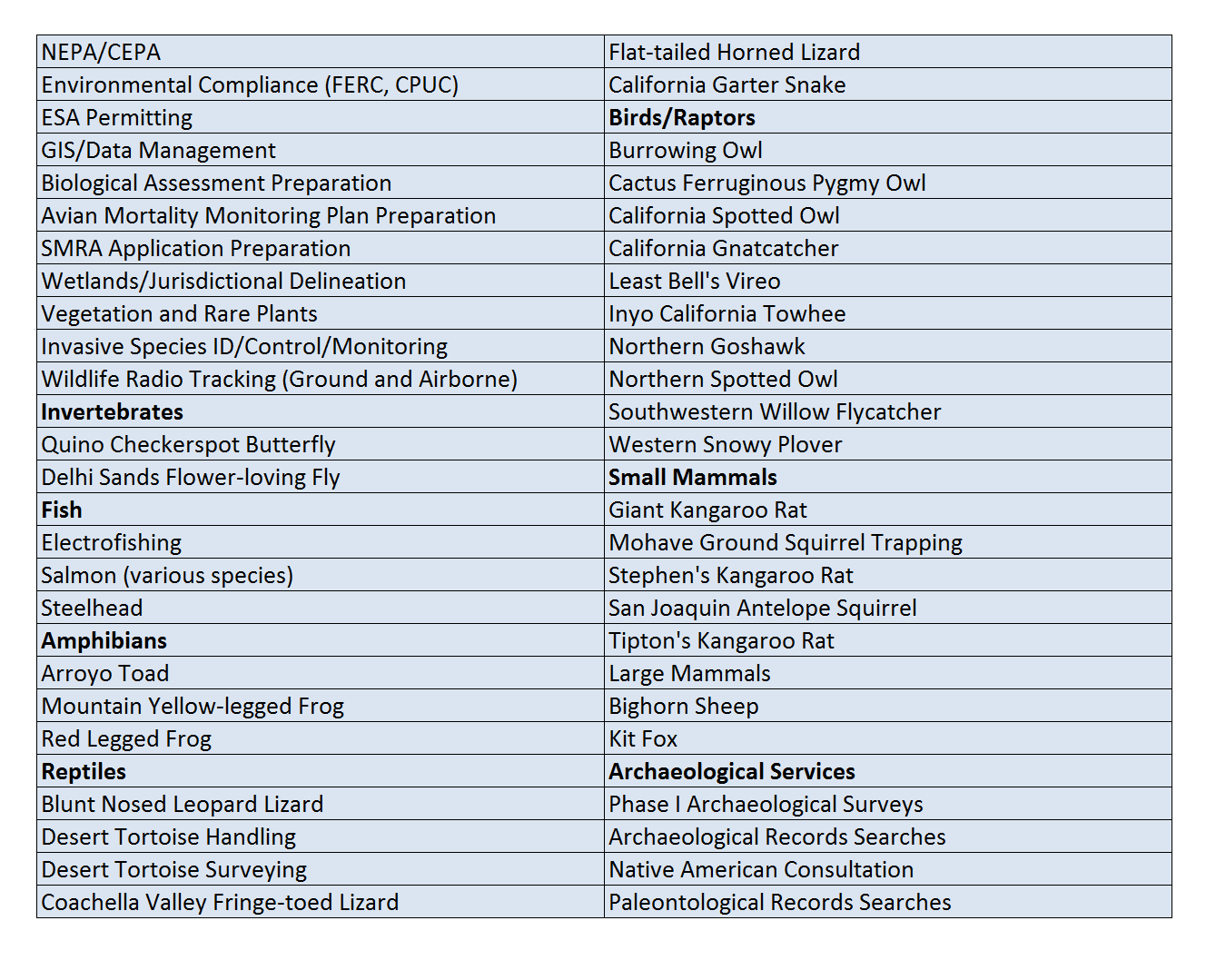
TABLE OF EXPERTISE
Below is a detailed table of our areas of expertise.
Aerial Services
EPC is uniquely positioned to provide aerial drone and helicopter services as both Glenn and Gilbert Goodlett are FAA licensed drone pilots. Glenn has performed over 2,810 incident-free flights while Gilbert is a licensed helicopter and fixed wing pilot with over 1,500 hours logged. EPC has comprehensive insurance for both of these operations.
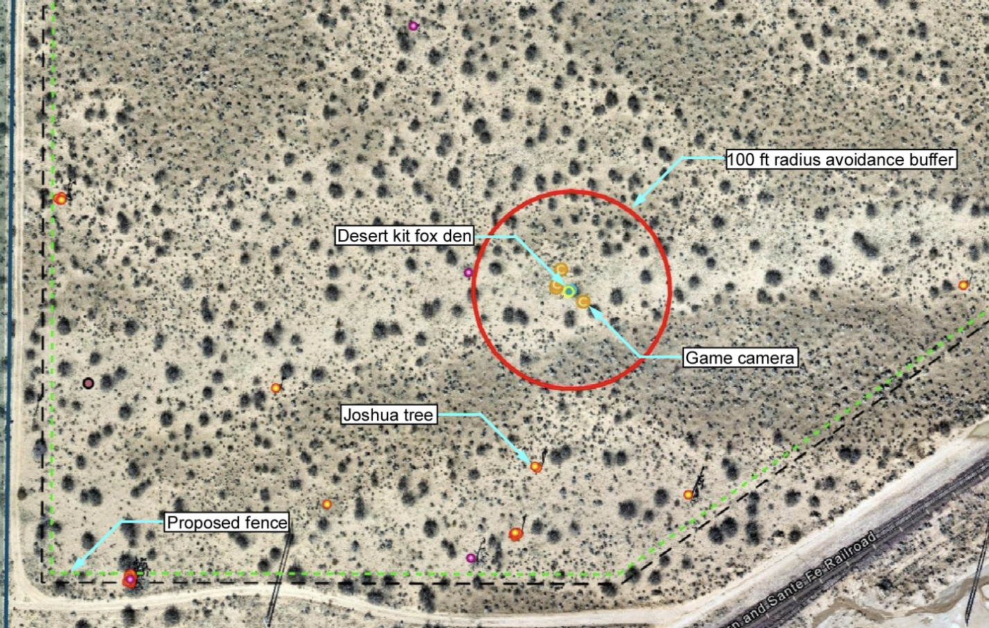
One of the commonly requested drone services includes high resolution aerial imagery of construction sites. This imagery is updated periodically, often weekly. The imagery is a composite of thousands of individual photographs that is imported into GIS software where natural resource and engineering data is overlaid. These data can then be provided via a mobile and/or desktop platform so that all project personnel can access. Below is an example snip showing an active desert kit fox den with a 100-radius avoidance buffer as prescribed by permits along with live and dead western Joshua trees and proposed project fencelines.
Other drone services have included capture of video and imagery of solar facilities for marketing and websites.
EPC has provided numerous helicopter services including translocation of over 1,000 desert tortoises at the Marine Corps Air-Ground Combat Center and 350 tortoises from Fort Irwin associated with expansion of these military bases. Helicopter translocation provided a fast, low-impact method of moving large numbers of desert tortoises safely to various destinations.
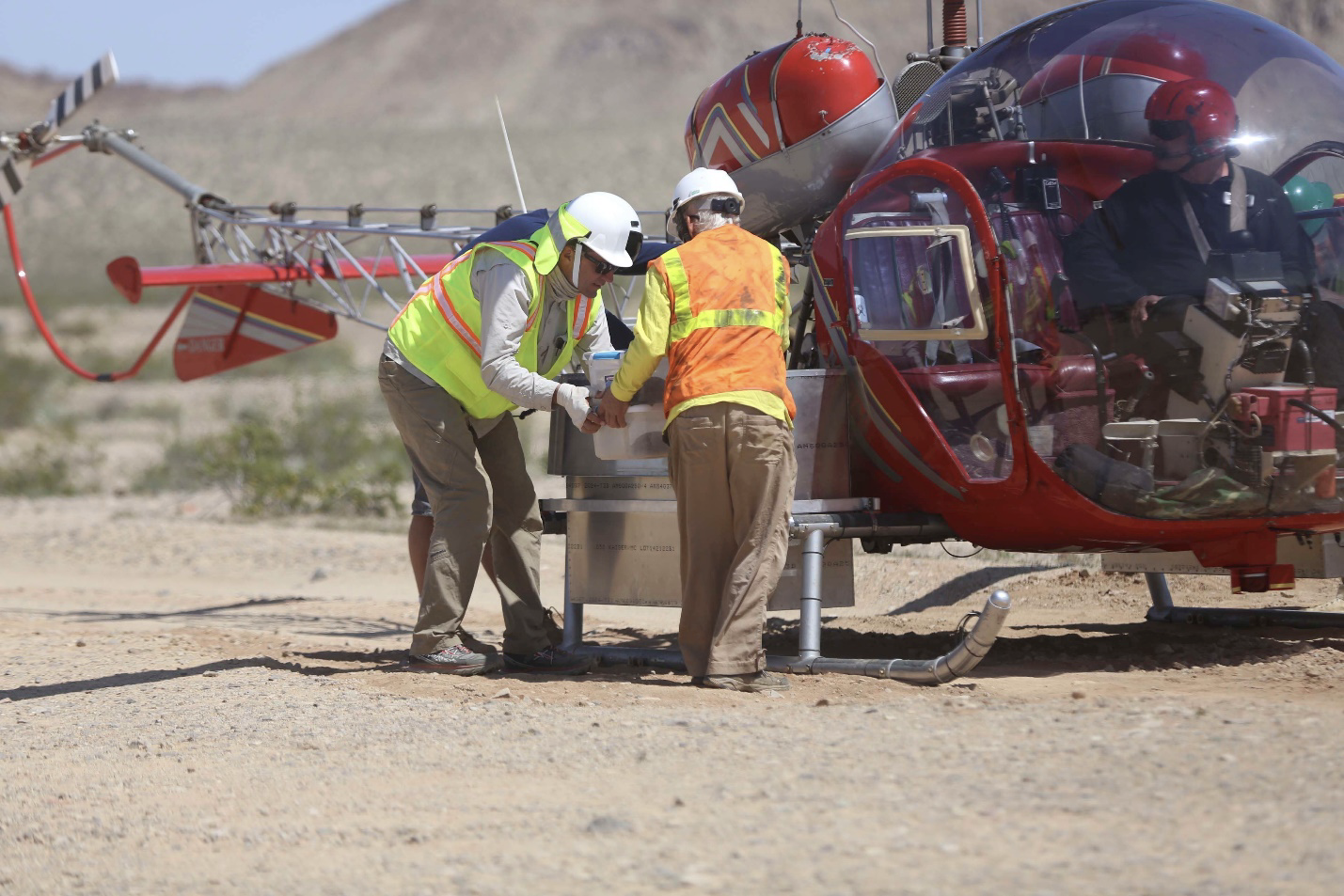
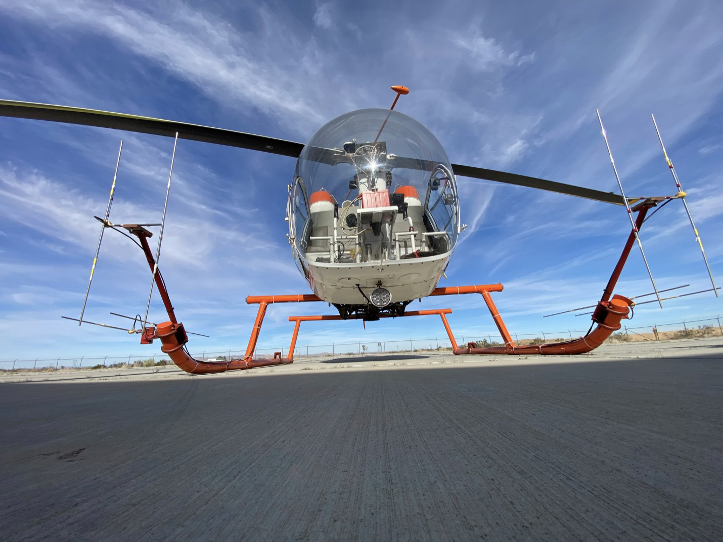
As a part of desert tortoise translocation efforts, animals are often affixed with radio transmitters to aid in their location. The range of these transmitters is limited with a ground based observer, particularly if the transmitter is damaged as is often the case as a result of coyotes pulling out the antenna. In these cases, EPC may be asked to search for the missing tortoises. Using airborne radio tracking equipment, EPC has a stunning track record of success finding missing tortoises.
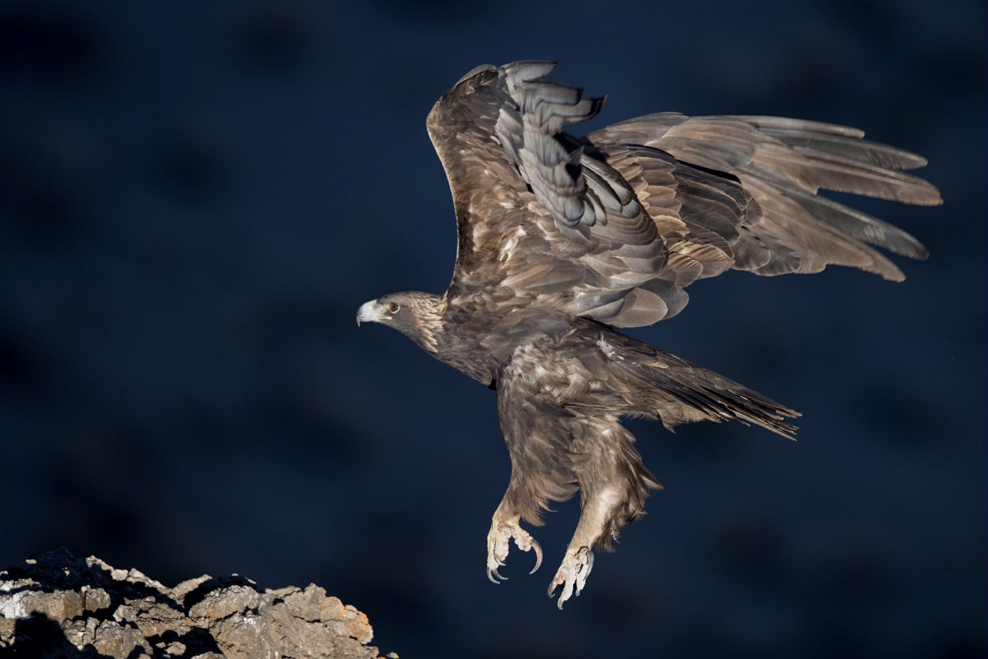
Additionally, EPC has conducted several protocol golden eagle helicopter surveys according to U.S. Fish and Wildlife Service protocols along with associated reporting.